Autocad Map 3D 2016 is a powerful software tool that combines the capabilities of AutoCAD with geospatial data. It provides engineers, architects, and GIS professionals with the ability to create, manage, and analyze intelligent maps and spatial data. In this blog post, we will explore the features and benefits of Autocad Map 3D 2016, and understand how it can enhance your design and analysis workflows.
Main Body
1. Overview of Autocad Map 3D 2016
Autocad Map 3D 2016 is a comprehensive mapping solution that allows users to access, visualize, and analyze geospatial data within the AutoCAD environment. It offers a wide range of tools and functionalities, including data integration, advanced visualization, thematic mapping, and data analysis.
2. Data Integration and Management
One of the key features of Autocad Map 3D 2016 is its ability to integrate various data sources, such as GIS data, CAD data, and databases. It provides tools to import, export, and link data, ensuring seamless integration and interoperability. With Autocad Map 3D 2016, you can easily access and manage all your geospatial data in one place, eliminating the need for multiple software applications.
3. Advanced Visualization and Thematic Mapping
Autocad Map 3D 2016 offers advanced visualization capabilities that allow users to create stunning and informative maps. The software provides a wide range of symbols, colors, and styles to represent different geospatial features. Additionally, it allows users to create thematic maps, where data is displayed using different colors or patterns to represent variations in attributes. This makes it easier to identify patterns, trends, and relationships within the data.
4. Analysis and Querying
Autocad Map 3D 2016 provides powerful analysis tools that enable users to perform spatial queries, overlay analysis, and proximity analysis. These tools can help you answer complex questions about your data, such as finding the nearest facilities, identifying areas of high risk, or analyzing spatial patterns. With Autocad Map 3D 2016, you can gain valuable insights from your geospatial data, leading to better decision-making and improved design processes.
5. Integration with AutoCAD
As Autocad Map 3D 2016 is built on the AutoCAD platform, it seamlessly integrates with other AutoCAD products. This integration allows users to combine the power of Autocad Map 3D 2016 with the extensive drafting and design capabilities of AutoCAD. It enables users to create detailed and accurate designs, while also incorporating geospatial data and analysis.
6. Collaboration and Communication
Autocad Map 3D 2016 facilitates collaboration and communication among team members by providing easy sharing and publishing options. Users can share their maps and data with others, allowing for better coordination and decision-making. Additionally, the software supports various industry standards, ensuring compatibility with other GIS and CAD tools.
Conclusion
Autocad Map 3D 2016 is a versatile software solution that combines the power of AutoCAD with advanced geospatial capabilities. It provides users with the ability to integrate, visualize, analyze, and communicate geospatial data effectively. Whether you are working on infrastructure projects, urban planning, or environmental analysis, Autocad Map 3D 2016 can greatly enhance your workflows and help you make informed decisions.
We have only scratched the surface of what Autocad Map 3D 2016 can do in this blog post. If you are interested in learning more about this powerful software tool or have any questions, please leave a comment below. We would love to hear your thoughts and experiences with Autocad Map 3D 2016.
Leave a comment and let us know how Autocad Map 3D 2016 has helped you in your projects.
Solved: Autocad Map 3D 2016 geolocation problems – Autodesk …
Jul 22, 2016 … “Cannot reorient Geographic Marker. Either the location or the assigned GIS coordinate system information is unavailable. Edit the location … – forums.autodesk.com

System requirements for AutoCAD Map 3D 2016
16 GB RAM or more. 20 GB free hard disk available not including installation requirements. 1600 x 1050 or greater True Color video display adapter; 128 MB VRAM … – www.autodesk.com
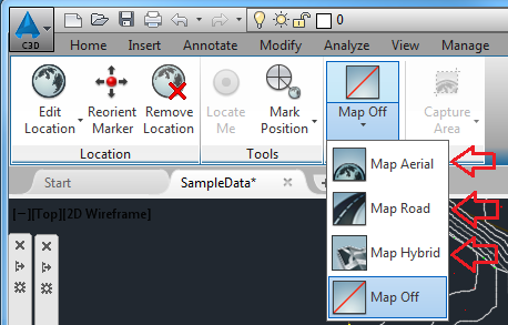
Import Google Maps with roads to AutoCAD Map 3D 2016 …
Oct 9, 2015 … Import Google Maps with roads to AutoCAD Map 3D 2016 · Mark as New · Bookmark · Subscribe · Mute · Subscribe to RSS Feed · Permalink · Print … – forums.autodesk.com
A Practical Guide to AutoCAD Map 3D 2016 – Cadapult Software
A Practical Guide to AutoCAD Map 3D 2016 · Navigate the latest workspace ribbons · Work with multiple coordinate systems · Create and edit mapping specific … – cadapult-software.com
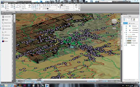
Autodesk, Inc. AutoCAD Map 3D 2016 – Citrix Ready Marketplace
With AutoCAD® Map 3D software, you can access and use CAD and GIS data from a range of sources. View images and video to see how comprehensive gas, water, … – citrixready.citrix.com

Autocad Map 3D 2016
Autocad Map 3D 2016 Download and Install Autodesk AutoCAD Map 3D 2016 Product Help Aug 10 2015 … To download and install the Autodesk® AutoCAD® Map 3D® 2016 offline Help select from the list of languages below. /a /p !– /wp:paragraph — /div !– /wp:group — !– wp:group — div class=wp-block-gro – drawspaces.com
Solved: importing LAS files to autocad map 3d 2016 – Autodesk …
Jan 26, 2016 … I solved it myself. All I had to do was manually type in the command MAPPOINTCLOUDMANAGER and it brought up the point cloud manager I needed to … – forums.autodesk.com

System requirements for AutoCAD Map 3D
System requirements for AutoCAD Map 3D. Autodesk Support. Oct 8, 2023. Products and versions covered … – www.autodesk.com
Solved: MAP 3D 2016 coordinate system problem – Autodesk …
Apr 1, 2015 … I found that MAP coordinate system librarys is stored in C:ProgramDataAutodesk. MAP 3d 2016 seems to keep coordinate system in folder ” … – forums.autodesk.com

AutoCAD Civil 3D 2016 Essentials: Autodesk… by Chappell, Eric
Book overview … AutoCAD Civil 3D 2016 Essentials gets you quickly up to speed with the features and functions of this industry-leading civil engineering … – www.amazon.com

3D Map Autocad
3D Map Autocad AutoCAD Map 3D Toolset Included with Official AutoCAD The AutoCAD Map 3D toolset is model-based GIS mapping software that provides access to CAD and GIS data to support planning design and management. www.autodesk.com Overview | AutoCAD Map 3D | Autodesk Knowledge Network Welcome to t – drawspaces.com

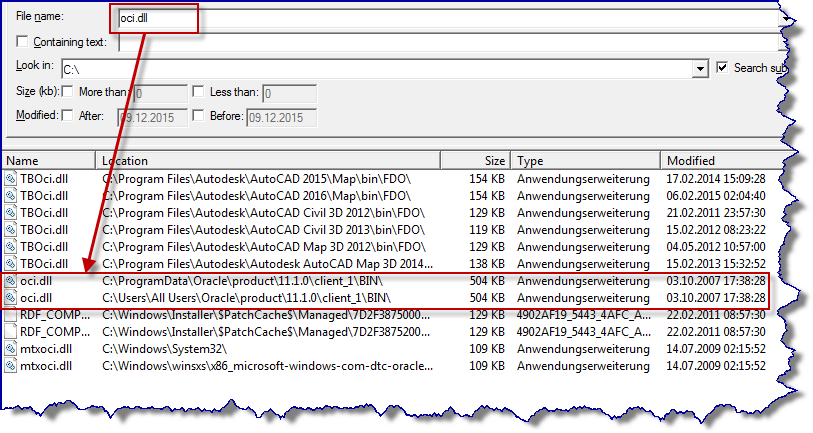
oci.dll Missing (Again) – Autodesk Community – AutoCAD Map 3D
Dec 8, 2015 … I’m having problems with AutoCAD Map 3D 2016 connecting to an Oracle database used for GIS geodatabase. This process used to work flawlessly … – forums.autodesk.com
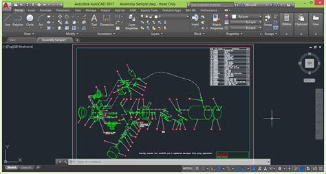
3D Drawing In Autocad 2020
3D Drawing In AutoCAD 2020: Unleashing Your Creativity Introduction In the world of computer-aided design (CAD) AutoCAD has been a go-to software for professionals and beginners alike. Its versatile features and powerful tools have made it an industry standard for creating precise and detailed drawi – drawspaces.com
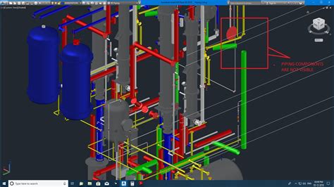
Autodesk Autocad Plant 3D 2020
Autodesk Autocad Plant 3D 2020: A Comprehensive Review In the ever-evolving field of engineering and design Autodesk has consistently delivered cutting-edge software solutions. One such powerful tool is Autodesk Autocad Plant 3D 2020 designed specifically for plant design and engineering professiona – drawspaces.com
Autocad 2016 Software Free Download
Autocad Free Alternative 10 Free AutoCAD Alternatives – SolidFace 3D CAD 10 Free AutoCAD Alternatives · 1. SolidFace – Download for Free · 2. BricsCAD · 3. DraftSight · 5. SketchUp · 6. AutoCAD (student version) · 7. FreeCAD · 8. NanoCAD … solidface.com The 11 Best AutoCAD Alternatives of 2022 (So – drawspaces.com

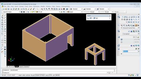
Autocad 2007 3D To 2D
AutoCAD 2007 3D to 2D: Mastering the Transition AutoCAD has revolutionized the world of design and drafting since its inception in 1982. With each new version the software has introduced innovative tools and features to enhance the user experience and streamline the design process. In this blog post – drawspaces.com
Map 3D Google
Map 3D Google 3D Imagery in Google Earth Google Earth is one of the world’s most comprehensive 3D maps available. In addition to global satellite and terrain coverage over the past several years … /a /p !– /wp:paragraph — /div !– /wp:column — !– wp:column {width:20%} — div class=wp-block-col – drawspaces.com

Drawing Autocad 3D
Drawing Autocad 3D AutoCAD 3D Drawing: All You Need to Get Started | All3DP Sep 18 2021 … AutoCAD 3D Drawing: All You Need to Get Started · Step 1: Opening a New File · Step 2: Selecting the Workspace · Step 3: Creating the Shape · Step 4 … all3dp.com 3 Simple Steps to Setting up 3D Drawings in – drawspaces.com

3D House Design In Autocad
3D House Design In Autocad: Transforming Architectural Visualization In the realm of architecture and design Autocad stands as a powerful tool that allows professionals to bring their visions to life. With its extensive capabilities 3D house design in Autocad has revolutionized the way architects en – drawspaces.com
How To Import Csv File Into Autocad Civil 3D
How To Import CSV File Into AutoCAD Civil 3D AutoCAD Civil 3D is a powerful software used in the field of civil engineering and design. One of its key functionalities is the ability to import data from external sources such as CSV files. In this blog post we will guide you through the step-by-step p – drawspaces.com
