In the ever-evolving field of urban planning, technology plays a crucial role in streamlining processes and improving productivity. One such technology is AutoCAD, a computer-aided design software widely used by architects, engineers, and urban planners. With its extensive range of tools and features, AutoCAD has become an integral part of the urban planning process. This blog post will explore the various ways in which AutoCAD is beneficial for urban planning, highlighting its ability to enhance efficiency, accuracy, visualization, collaboration, and sustainability.
I. Enhanced Efficiency:
One of the primary benefits of AutoCAD in urban planning is the significant improvement in efficiency it brings. The software enables planners to quickly create, modify, and analyze complex 2D and 3D designs. With AutoCAD, urban planners can easily generate detailed drawings, maps, and models, allowing for more efficient decision-making and communication with stakeholders. The software’s automation capabilities also help in reducing manual errors and repetitive tasks, saving time and effort.
II. Improved Accuracy:
Accurate measurements and precise calculations are crucial for successful urban planning projects. AutoCAD provides tools that enable planners to accurately measure distances, areas, and volumes, ensuring the accuracy of the designs. Additionally, the software allows for the precise placement of objects and elements within the urban environment, enabling planners to create realistic representations of the proposed plans. This accuracy not only enhances the overall quality of the project but also helps in avoiding costly mistakes during the construction phase.
III. Enhanced Visualization:
Visualizing urban plans is a fundamental aspect of the planning process. AutoCAD offers powerful visualization tools that allow planners to create realistic and immersive representations of their designs. By generating 3D models and renderings, AutoCAD enables planners to visualize the proposed developments from different angles, helping them make informed decisions and effectively communicate their ideas to clients, stakeholders, and the general public. The ability to visualize the project also facilitates public engagement and consensus-building, ensuring that the final plans align with the community’s needs and aspirations.
IV. Improved Collaboration:
Collaboration is key in urban planning, as it involves multiple stakeholders working together towards a common goal. AutoCAD offers robust collaboration features that enable planners, architects, engineers, and other professionals to work seamlessly on the same project. The software allows for easy sharing and editing of design files, ensuring that everyone involved has access to the most up-to-date information. This collaborative approach fosters better coordination, reduces conflicts, and improves overall project outcomes.
V. Sustainable Planning:
In today’s world, sustainable urban planning is of utmost importance. AutoCAD provides tools and features that help urban planners incorporate sustainable practices into their designs. The software allows for the accurate analysis of energy consumption, water usage, and environmental impact, enabling planners to make informed decisions that promote sustainability. AutoCAD’s ability to simulate and analyze different scenarios also helps in optimizing resource allocation and minimizing the ecological footprint of urban developments.
VI. Conclusion:
AutoCAD has undoubtedly revolutionized the field of urban planning, offering numerous benefits that enhance efficiency, accuracy, visualization, collaboration, and sustainability. The software’s extensive range of tools and features empowers planners to create detailed designs, visualize projects effectively, and collaborate seamlessly with stakeholders. With AutoCAD, urban planners can make informed decisions, avoid costly mistakes, and ensure that their projects align with the needs of the community and the principles of sustainability.
In conclusion, AutoCAD has become an invaluable tool for urban planners worldwide, enabling them to navigate the complexities of urban development with ease. As technology continues to advance, it is imperative for urban planners to embrace tools like AutoCAD to stay ahead and deliver the best possible outcomes for the cities of the future.
We would love to hear your thoughts on how AutoCAD has benefited urban planning. Leave a comment below and let us know your experiences and opinions!
Urban Planning and Design Based on AutoCAD to Expand GIS …
For the drawing of planning drawings, it is a good method to draw different types of entities separately according to layers. It can make the management of … – cad-journal.net
How To Use Autocad For Beginners
How To Use Autocad For Beginners AutoCAD Basic Tutorial for Beginners – Part 1 of 3 – YouTube Jun 20 2019 … In this AutoCAD Tutorial for beginner video series you will learn about AutoCAD from scratch. Learn AutoCAD with full-length video courses … www.youtube.com https://www.youtube.com/watch?v – drawspaces.com

What is the best software for creating a masterplan or town planning …
It offers a range of tools for drawing, editing, and sharing your designs. SketchUp allows for exporting your design to AutoCAD file formats, including DWG and … – www.quora.com
AutoCAD for Site Planning | Planetizen Courses
Apr 3, 2014 … … Urban Design at MIT’s Department Studies and Planning (DUSP). Prior … It is a good course for planners of architects who want to work with site … – courses.planetizen.com
Is Autocad For Mac Different Than Windows
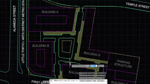
Is AutoCAD For Mac Different Than Windows? AutoCAD is a leading computer-aided design (CAD) software used by architects engineers and professionals in various industries worldwide. For many years AutoCAD was primarily available for Windows operating systems. However with the increasing popularity of – drawspaces.com

Which Autocad Version Is Best For Windows 7
Which AutoCAD Version Is Best For Windows 7? AutoCAD is a widely used software program for computer-aided design and drafting. Many users still rely on Windows 7 as their operating system and finding the right AutoCAD version that is compatible with it can be crucial. In this blog post we will explo – drawspaces.com

Is Ryzen 5 Good For Autocad
Is Ryzen 5 Good For Autocad? Introduction Autocad is a powerful computer-aided design (CAD) software widely used by professionals in various industries such as architecture engineering and construction. When it comes to running Autocad smoothly and efficiently it is crucial to have a reliable and hi – drawspaces.com

Is Integrated Graphics Good For Autocad
Is Integrated Graphics Good For Autocad? Autodesk’s AutoCAD is a powerful and widely used computer-aided design software that demands robust hardware resources for optimal performance. One crucial component that significantly impacts the user experience is the graphics card. In this blog post we wil – drawspaces.com
Which Autocad Version Is Best For Windows 10
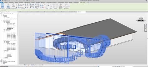
Which Autocad Version Is Best For Windows 10 Introduction Autocad the industry-leading software for computer-aided design (CAD) is widely used by architects engineers and designers. With the release of Windows 10 many users have been wondering which Autocad version is best suited for this new operat – drawspaces.com
ArcGIS Urban FAQs – Esri Community
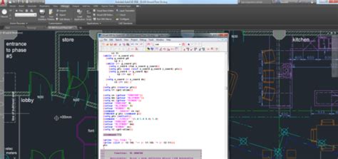
Oct 15, 2019 … Besides from Urban planning, can other sectors benefit from using Urban? … There are two options to bring AutoCAD data into Urban: 1. CAD … – community.esri.com
As a planner, how valuable are programs like AutoCAD and …
Dec 23, 2012 … Personally though, (I have my Master in Urban Planning from Queen’s … But complicated models are best left to the pros of Autodesk et al. – www.reddit.com
Urban Design and Planning | Urban Design Software | Autodesk
Good urban design considers what responsible, sustainable growth looks like, and it considers the environmental impact of development and long-term living … – www.autodesk.com

Why Autocad Is So Expensive
Why AutoCAD Is So Expensive: Unveiling the Price Tag Behind the Industry Leader Introduction AutoCAD the ubiquitous computer-aided design (CAD) software has long held its position as the industry leader in its field. While it boasts an impressive array of features and capabilities one cannot ignore – drawspaces.com

How To Print All Sheets Autocad
How To Print All Sheets AutoCAD AutoCAD is a powerful software tool widely used in the architecture engineering and construction industries for creating and designing 2D and 3D models. One common requirement when working on large projects is the need to print all sheets at once. In this blog post we – drawspaces.com
Scale Factor For Autocad
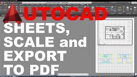
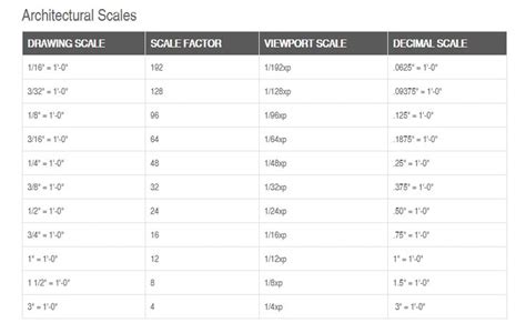
Scale Factor For AutoCAD: A Comprehensive Guide for Accurate Drawings When it comes to creating precise and professional drawings in AutoCAD understanding the concept of scale factor is crucial. Whether you are an architect engineer or designer properly scaling your drawings ensures accuracy and con – drawspaces.com
How To Record Autocad Video
How to Record AutoCAD Video: A Comprehensive Guide In today’s digital age visual communication plays a vital role in sharing information effectively. When it comes to AutoCAD recording videos of your design process can be incredibly useful for presentations tutorials or simply documenting your work. – drawspaces.com

Autodesk Civil 3D Help | Urban Subassemblies | Autodesk
Use these subassemblies to add curb, gutter, and sidewalk structures to road assemblies that are typically used in urban design applications. – help.autodesk.com
Solved: How to easily design stairs ? – Autodesk Community – Civil 3D
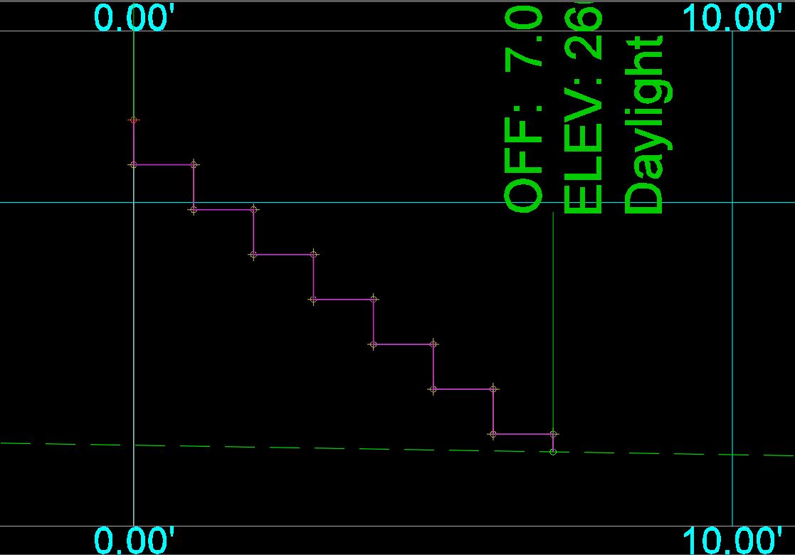
May 4, 2019 … Solved: Good morning, everyone. I am a quite new user of Civil 3D. I am currently working on an urban planning project. – forums.autodesk.com
CADMAPPER: Worldwide map files for any design program
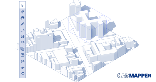
It’s free for areas up to 1 km2 and over 200 whole city DXF files. WORKS BEST WITH. autocad program AutoCAD. rhino program Rhinoceros 5+. sketchup program … – cadmapper.com
Autodesk Acquires Spacemaker: Offers Architects AI-powered …
Autodesk Acquires Spacemaker: Offers Architects AI-powered Generative Design to Explore Best Urban Design Options. 17 NOV 2020. Categories: Press Releases … – adsknews.autodesk.com
